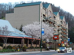
File: YDSCN0047.JPG
Click image for full resolution display.
Exif parsing courtesy of Phil Harvey's ExifTool. |
| F I L E |
| FileName | | YDSCN0047.JPG |
| FileSize | | 7.2 MB |
| FileModifyDate | | 2013:04:19 07:51:42-04:00 |
| FileAccessDate | | 2013:04:19 07:50:32-04:00 |
| FileType | | JPEG |
| MIMEType | | image/jpeg |
| ExifByteOrder | | Little-endian (Intel, II) |
| ImageWidth | | 4608 |
| ImageHeight | | 3456 |
| EncodingProcess | | Baseline DCT, Huffman coding |
| BitsPerSample | | 8 |
| ColorComponents | | 3 |
| YCbCrSubSampling | | YCbCr4:2:2 (2 1) |
| E X I F |
| ImageDescription | | |
| Make | | NIKON |
| Model | | COOLPIX S800c |
| Orientation | | Horizontal (normal) |
| XResolution | | 300 |
| YResolution | | 300 |
| ResolutionUnit | | inches |
| Software | | COOLPIX S800c V1.1 |
| ModifyDate | | 2013:04:06 19:45:41 |
| YCbCrPositioning | | Co-sited |
| ExposureTime | | 1/30 |
| FNumber | | 4.3 |
| ExposureProgram | | Program AE |
| ISO | | 250 |
| SensitivityType | | Standard Output Sensitivity |
| ExifVersion | | 0230 |
| DateTimeOriginal | | 2013:04:06 19:45:41 |
| CreateDate | | 2013:04:06 19:45:41 |
| ComponentsConfiguration | | Y, Cb, Cr, - |
| CompressedBitsPerPixel | | 4 |
| ExposureCompensation | | 0 |
| MaxApertureValue | | 3.2 |
| MeteringMode | | Multi-segment |
| LightSource | | Unknown |
| Flash | | Off, Did not fire |
| FocalLength | | 11.7 mm |
| UserComment | | |
| FlashpixVersion | | 0100 |
| ColorSpace | | sRGB |
| ExifImageWidth | | 4608 |
| ExifImageHeight | | 3456 |
| InteropIndex | | R98 - DCF basic file (sRGB) |
| InteropVersion | | 0100 |
| FileSource | | Digital Camera |
| SceneType | | Directly photographed |
| CustomRendered | | Normal |
| ExposureMode | | Auto |
| WhiteBalance | | Auto |
| DigitalZoomRatio | | 0 |
| FocalLengthIn35mmFormat | | 65 mm |
| SceneCaptureType | | Standard |
| GainControl | | Low gain up |
| Contrast | | Normal |
| Saturation | | Normal |
| Sharpness | | Normal |
| SubjectDistanceRange | | Unknown |
| GPSVersionID | | 2.3.0.0 |
| GPSLatitudeRef | | North |
| GPSLatitude | | 35 deg 42' 29.92" |
| GPSLongitudeRef | | West |
| GPSLongitude | | 4366561931 deg 12' 36.75" |
| GPSAltitudeRef | | Above Sea Level |
| GPSAltitude | | 366 m |
| GPSTimeStamp | | 19:46:08 |
| GPSSatellites | | 8 |
| GPSMapDatum | | WGS84 |
| GPSProcessingMethod | | GPS |
| GPSDateStamp | | 2013:04:06 |
| Compression | | JPEG (old-style) |
| XResolution | | 300 |
| YResolution | | 300 |
| ResolutionUnit | | inches |
| ThumbnailOffset | | 12800 |
| ThumbnailLength | | 7276 |
| M A K E R N O T E S |
| MakerNoteVersion | | 2.00 |
| ISO | | 0 |
| ColorMode | | Color |
| Quality | | Fine |
| WhiteBalance | | Auto |
| Sharpness | | Auto |
| FocusMode | | AF-S |
| FlashSetting | | |
| WhiteBalanceFineTune | | 0 |
| ISOSelection | | Auto |
| DataDump | | (binary data) |
| Compression | | JPEG (old-style) |
| XResolution | | 300 |
| YResolution | | 300 |
| ResolutionUnit | | inches |
| PreviewImageStart | | 23296 |
| PreviewImageLength | | 31459 |
| YCbCrPositioning | | Co-sited |
| ImageProcessing | | � � |
| HDR | | Off |
| HDRLevel | | Auto |
| HDRSmoothing | | Off |
| ImageAdjustment | | Auto |
| ManualFocusDistance | | undef |
| DigitalZoom | | 1 |
| AFAreaMode | | Single Area |
| AFPoint | | Center |
| AFPointsInFocus | | Center, Bottom, Mid-left, Mid-right, Upper-right, Lower-left, Lower-right |
| SceneMode | | |
| Saturation | | 0 |
| NoiseReduction | | Off |
| SceneAssist | | |
| RetouchHistory | | None |
| ImageStabilization | | VR-On |
| C O M P O S I T E |
| Aperture | | 4.3 |
| GPSAltitude | | 366 m Above Sea Level |
| GPSDateTime | | 2013:04:06 19:46:08Z |
| GPSLatitude | | 35 deg 42' 29.92" N |
| GPSLongitude | | 4366561931 deg 12' 36.75" W |
| GPSPosition | | 35 deg 42' 29.92" N, 4366561931 deg 12' 36.75" W |
| ImageSize | | 4608x3456 |
| PreviewImage | | (binary data) |
| ScaleFactor35efl | | 5.6 |
| ShutterSpeed | | 1/30 |
| ThumbnailImage | | (binary data) |
| CircleOfConfusion | | 0.005 mm |
| FOV | | 31.0 deg |
| FocalLength35efl | | 11.7 mm (35 mm equivalent: 65.0 mm) |
| HyperfocalDistance | | 5.89 m |
| LightValue | | 7.8 |
|