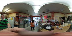
File: YR0010292.JPG
Click image for full resolution display.
Exif parsing courtesy of Phil Harvey's ExifTool. |
| F I L E |
| FileName | | YR0010292.JPG |
| FileSize | | 3.9 MB |
| FileModifyDate | | 2015:10:11 00:43:25-04:00 |
| FileAccessDate | | 2015:10:11 00:44:53-04:00 |
| FileInodeChangeDate | | 2015:10:11 00:43:25-04:00 |
| FileType | | JPEG |
| FileTypeExtension | | jpg |
| MIMEType | | image/jpeg |
| ExifByteOrder | | Big-endian (Motorola, MM) |
| ImageWidth | | 5376 |
| ImageHeight | | 2688 |
| EncodingProcess | | Baseline DCT, Huffman coding |
| BitsPerSample | | 8 |
| ColorComponents | | 3 |
| YCbCrSubSampling | | YCbCr4:2:2 (2 1) |
| E X I F |
| ImageDescription | | |
| Make | | RICOH |
| Model | | RICOH THETA S |
| Orientation | | Horizontal (normal) |
| XResolution | | 72 |
| YResolution | | 72 |
| ResolutionUnit | | inches |
| Software | | RICOH THETA S Ver 1.11 |
| ModifyDate | | 2015:09:26 09:47:11 |
| YCbCrPositioning | | Co-sited |
| Copyright | | |
| ExposureTime | | 1/60 |
| FNumber | | 2.0 |
| ExposureProgram | | Program AE |
| ISO | | 100 |
| SensitivityType | | Standard Output Sensitivity |
| ExifVersion | | 0230 |
| DateTimeOriginal | | 2015:09:26 09:47:11 |
| CreateDate | | 2015:09:26 09:47:11 |
| ComponentsConfiguration | | Y, Cb, Cr, - |
| CompressedBitsPerPixel | | 3.2 |
| ApertureValue | | 2.0 |
| BrightnessValue | | 2.7 |
| ExposureCompensation | | 0 |
| MaxApertureValue | | 2.0 |
| MeteringMode | | Multi-segment |
| LightSource | | Unknown |
| Flash | | No Flash |
| FocalLength | | 1.3 mm |
| UserComment | | |
| FlashpixVersion | | 0100 |
| ColorSpace | | sRGB |
| ExifImageWidth | | 5376 |
| ExifImageHeight | | 2688 |
| InteropIndex | | R98 - DCF basic file (sRGB) |
| InteropVersion | | 0100 |
| ExposureMode | | Auto |
| WhiteBalance | | Auto |
| SceneCaptureType | | Standard |
| Sharpness | | Normal |
| GPSVersionID | | 2.3.0.0 |
| GPSLatitudeRef | | North |
| GPSLatitude | | 37 deg 23' 37.27" |
| GPSLongitudeRef | | West |
| GPSLongitude | | 122 deg 4' 44.57" |
| GPSAltitudeRef | | Above Sea Level |
| GPSAltitude | | 0 m |
| GPSTimeStamp | | 09:41:50 |
| GPSImgDirectionRef | | True North |
| GPSImgDirection | | 112.5 |
| GPSMapDatum | | WGS84 |
| GPSDateStamp | | 2015:09:26 |
| Compression | | JPEG (old-style) |
| XResolution | | 72 |
| YResolution | | 72 |
| ResolutionUnit | | inches |
| ThumbnailOffset | | 58496 |
| ThumbnailLength | | 3085 |
| M A K E R N O T E S |
| MakerNoteType | | Rdc |
| FirmwareVersion | | 1.11 |
| SerialNumber | | (00000000)00010006 |
| RecordingFormat | | JPEG |
| Accelerometer | | 359.4 1.8 |
| Compass | | 112.5 |
| ExposureProgram | | Auto |
| WhiteBalance | | Auto |
| X M P |
| XMPToolkit | | RICOH THETA S Ver1.11 |
| ProjectionType | | equirectangular |
| UsePanoramaViewer | | True |
| CroppedAreaImageWidthPixels | | 5376 |
| CroppedAreaImageHeightPixels | | 2688 |
| FullPanoWidthPixels | | 5376 |
| FullPanoHeightPixels | | 2688 |
| CroppedAreaLeftPixels | | 0 |
| CroppedAreaTopPixels | | 0 |
| PoseHeadingDegrees | | 112.5 |
| PosePitchDegrees | | 1.8 |
| PoseRollDegrees | | -0.6 |
| C O M P O S I T E |
| Aperture | | 2.0 |
| GPSAltitude | | 0 m Above Sea Level |
| GPSDateTime | | 2015:09:26 09:41:50Z |
| GPSLatitude | | 37 deg 23' 37.27" N |
| GPSLongitude | | 122 deg 4' 44.57" W |
| GPSPosition | | 37 deg 23' 37.27" N, 122 deg 4' 44.57" W |
| ImageSize | | 5376x2688 |
| Megapixels | | 14.5 |
| RicohPitch | | 1.8 |
| RicohRoll | | -0.600000000000023 |
| ShutterSpeed | | 1/60 |
| ThumbnailImage | | (binary data) |
| FocalLength35efl | | 1.3 mm |
| LightValue | | 7.9 |
|